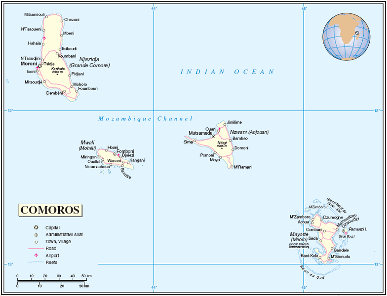
Файл:Comoros Mayotte.PNG

Розмір того нагляду: 784 × 600 пікселів. іншы розлишіня: 314 × 240 пікселів | 628 × 480 пікселів | 847 × 648 пікселів.
Оріґіналный файл (847 × 648 пікселів, розмір файлу: 70 КБ, MIME-тип: image/png)
Історія файлу
Кликнути на датум/час, жебы видїти, як тогды вызерав файл.
| Датум/час | Мініатура | Розмір обєкта | Хоснователь | Коментарь | |
|---|---|---|---|---|---|
| актуална | 06:04, 26 юлія 2005 |  | 847 × 648 (70 КБ) | Taichi | Map of Comoros and Mayotte Source: http://www.un.org/Depts/Cartographic/map/profile/comoros.pdf About the maps: The United Nations cartographics section claims: :''Unless otherwise noted, the maps included on this web site are produced by the Cartograph |
Хоснованя файлу
Далша сторінка ся одказує на тот файл:
Ґлобалне хоснованя файлу
Тот файл хоснують такы іншы вікі:
- Хоснованя на ar.wikipedia.org
- Хоснованя на ast.wikipedia.org
- Хоснованя на cbk-zam.wikipedia.org
- Хоснованя на ceb.wikipedia.org
- Хоснованя на en.wikipedia.org
- Хоснованя на eo.wikipedia.org
- Хоснованя на es.wikipedia.org
- Хоснованя на fr.wikipedia.org
- Хоснованя на gl.wikipedia.org
- Хоснованя на he.wikipedia.org
- Хоснованя на ja.wikipedia.org
- Хоснованя на lfn.wikipedia.org
- Хоснованя на mg.wikipedia.org
- Хоснованя на mt.wikipedia.org
- Хоснованя на pt.wikipedia.org
- Хоснованя на ro.wikipedia.org
- Хоснованя на ru.wikipedia.org
- Хоснованя на sv.wikipedia.org
- Хоснованя на tr.wikipedia.org
- Хоснованя на uk.wikipedia.org
- Хоснованя на www.wikidata.org
- Хоснованя на zh.wikipedia.org
